Geolocate

Townsend topographic map

Click on the map to display elevation.

About this map

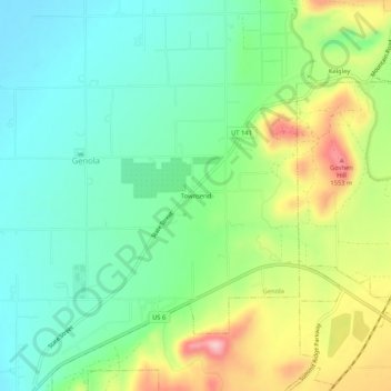
Name: Townsend topographic map, elevation, terrain.

Location: Townsend, Genola, Utah County, Utah, 84655, United States (39.97273 -111.84855 40.01273 -111.80855)

Average elevation: 1,438 m

Minimum elevation: 1,371 m

Maximum elevation: 1,568 m

Gear up for your next adventure:

🛌Insulated Sleeping Mats - Crucial thermal protection when sleeping on cold, uneven ground
📕Outdoor Navigation Books - Learn traditional and modern navigation techniques
🗺️Scratch-off Peak Maps - Track your progress climbing Munros or Wainwrights
🧢Thermal Beanie Hats - Prevent heat loss from the head in windy summit conditions
🧰First Aid Kits - Essential safety kits for outdoor activities

As an Amazon Associate, this site earns from qualifying purchases at no extra cost to you.