Geolocate

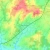
Henfield topographic map

Click on the map to display elevation.

About this map

Name: Henfield topographic map, elevation, terrain.

Location: Henfield, Horsham, West Sussex, England, United Kingdom (50.90320 -0.31034 50.95664 -0.24418)

Average elevation: 14 m

Minimum elevation: -2 m

Maximum elevation: 52 m

West Sussex trails, hiking, mountain biking, running and outdoor activities

Other topographic maps

Click on a map to view its topography, its elevation and its terrain.
Cootham

United Kingdom > England > West Sussex > Horsham > Storrington

Average elevation: 51 m

Horsham

United Kingdom > England > West Sussex > Horsham

Average elevation: 62 m

Wiggonholt

United Kingdom > England > West Sussex > Horsham > Wiggonholt

Average elevation: 17 m

Hardham

United Kingdom > England > West Sussex > Horsham > Coldwaltham

Average elevation: 13 m

Wineham

United Kingdom > England > West Sussex > Horsham

Average elevation: 18 m

Barns Green

United Kingdom > England > West Sussex > Horsham

Average elevation: 49 m

Horsham

United Kingdom > England > West Sussex > Horsham

Average elevation: 62 m

Hardham

United Kingdom > England > West Sussex > Horsham > Coldwaltham

Average elevation: 13 m

Horsham

United Kingdom > England > West Sussex > Horsham

Average elevation: 62 m

Gear up for your next adventure:

🖼️Topographic Map Art - Decorative 3D-effect posters of famous UK peaks and regions
🧊Insulated Flasks - Keeps drinks hot or cold during hikes
🧼Technical Clothing Wash - Special soap to clean and restore waterproof membranes
⛺Camping Shelters - Emergency and lightweight shelters for outdoor use
🧢Waterproof Hiking Hats - Keep the rain off your face while studying topographic maps

As an Amazon Associate, this site earns from qualifying purchases at no extra cost to you.