Geolocate

Calaca topographic map

Click on the map to display elevation.

About this map

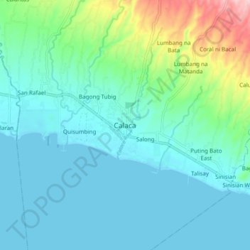
Name: Calaca topographic map, elevation, terrain.

Location: Calaca, Batangas, Calabarzon, 4212, Philippines (13.89045 120.77310 13.97045 120.85310)

Average elevation: 43 m

Minimum elevation: 0 m

Maximum elevation: 227 m

Gear up for your next adventure:

👕Merino Base Layers - Natural temperature regulation for cold weather hiking and camping
🩹Hiking First Aid Kits - Compact medical kits tailored for trail injuries and emergencies
🔋Power Banks - Portable chargers for long outdoor trips
📸Action Camera Chest Mounts - Record your ascent following topographic paths hands-free
🥾Men's Waterproof Hiking Boots - Durable footwear with deep lugs for muddy and rocky UK terrains

As an Amazon Associate, this site earns from qualifying purchases at no extra cost to you.