
Thank you for supporting this site ❤️
Make a donation
Make a donation
Gear up for your next adventure:
As an Amazon Associate, this site earns from qualifying purchases at no extra cost to you.
Calauan topographic map
Click on the map to display elevation.
Thank you for supporting this site ❤️
Make a donation
Make a donation
Gear up for your next adventure:
As an Amazon Associate, this site earns from qualifying purchases at no extra cost to you.
About this map
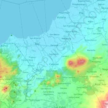
Name: Calauan topographic map, elevation, terrain.
Location: Calauan, Silangan, Laguna, Calabarzon, 4012, Philippines (14.06866 121.21746 14.25726 121.35359)
Average elevation: 93 m
Minimum elevation: -3 m
Maximum elevation: 735 m
Thank you for supporting this site ❤️
Make a donation
Make a donation
Gear up for your next adventure:
As an Amazon Associate, this site earns from qualifying purchases at no extra cost to you.