
Thank you for supporting this site ❤️
Make a donation
Make a donation
Gear up for your next adventure:
As an Amazon Associate, this site earns from qualifying purchases at no extra cost to you.
Díkeri topographic map
Click on the map to display elevation.
Thank you for supporting this site ❤️
Make a donation
Make a donation
Gear up for your next adventure:
As an Amazon Associate, this site earns from qualifying purchases at no extra cost to you.
About this map
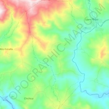
Name: Díkeri topographic map, elevation, terrain.
Location: Díkeri, Distrito Müna, Ngäbe-Buglé, Panamá (8.35706 -81.66977 8.44253 -81.62127)
Average elevation: 507 m
Minimum elevation: 231 m
Maximum elevation: 1,059 m
Thank you for supporting this site ❤️
Make a donation
Make a donation
Gear up for your next adventure:
As an Amazon Associate, this site earns from qualifying purchases at no extra cost to you.