Geolocate

Clumber topographic map

Click on the map to display elevation.

About this map

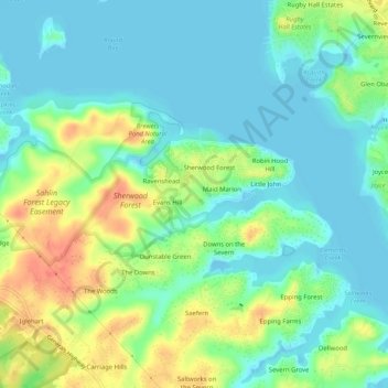
Name: Clumber topographic map, elevation, terrain.

Location: Clumber, Anne Arundel County, Maryland, 21405, United States (39.00483 -76.56580 39.04483 -76.52580)

Average elevation: 17 m

Minimum elevation: -2 m

Maximum elevation: 51 m

Gear up for your next adventure:

Insulated Travel Mugs - Keep drinks hot while surveying the landscape from a summit
🧥Breathable Waterproof Jackets - Essential rain protection for the unpredictable British climate
Lightweight Tents - Compact tents for backpacking and trekking
🧥Waterproof Hiking Jackets - Rain protection for walking in all weather conditions
🧊Insulated Flasks - Keeps drinks hot or cold during hikes

As an Amazon Associate, this site earns from qualifying purchases at no extra cost to you.