
Dietenhofen topographic map
Interactive map
Click on the map to display elevation.
About this map
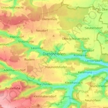
Name: Dietenhofen topographic map, elevation, terrain.
Location: Dietenhofen, Landkreis Ansbach, Bayern, 90599, Deutschland (49.36021 10.64853 49.44021 10.72853)
Average elevation: 392 m
Minimum elevation: 326 m
Maximum elevation: 460 m