
Pasni topographic map
Interactive map
Click on the map to display elevation.
About this map
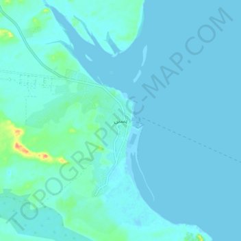
Name: Pasni topographic map, elevation, terrain.
Location: Pasni, Gwadar District, Balochistan, 767, Pakistan (25.22438 63.43235 25.30438 63.51235)
Average elevation: 5 m
Minimum elevation: -1 m
Maximum elevation: 48 m