
Make a donation
Gear up for your next adventure:
As an Amazon Associate, this site earns from qualifying purchases at no extra cost to you.
Whittington topographic map
Click on the map to display elevation.
Make a donation
Gear up for your next adventure:
As an Amazon Associate, this site earns from qualifying purchases at no extra cost to you.
About this map
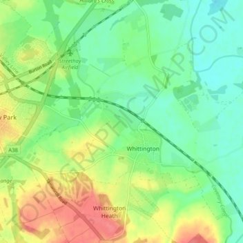
Name: Whittington topographic map, elevation, terrain.
Location: Whittington, Lichfield, Staffordshire, England, United Kingdom (52.65556 -1.80503 52.70314 -1.74408)
Average elevation: 70 m
Minimum elevation: 47 m
Maximum elevation: 107 m
Staffordshire trails, hiking, mountain biking, running and outdoor activities
Make a donation
Gear up for your next adventure:
As an Amazon Associate, this site earns from qualifying purchases at no extra cost to you.
Other topographic maps
Click on a map to view its topography, its elevation and its terrain.
Fulfen Wood
United Kingdom > England > Staffordshire > Lichfield > Whittington > Streethay
Average elevation: 69 m