
Gerstruben topographic map
Interactive map
Click on the map to display elevation.
About this map
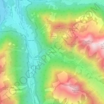
Name: Gerstruben topographic map, elevation, terrain.
Location: Gerstruben, Oberstdorf, Landkreis Oberallgäu, Bavaria, Germany (47.34947 10.29319 47.38947 10.33319)
Average elevation: 1,303 m
Minimum elevation: 820 m
Maximum elevation: 2,007 m