
Grellingen topographic map
Interactive map
Click on the map to display elevation.
About this map
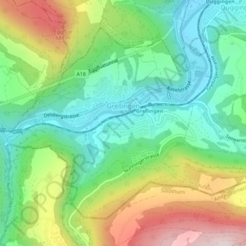
Name: Grellingen topographic map, elevation, terrain.
Location: Grellingen, Bezirk Laufen, Basel-Landschaft, 4203, Switzerland (47.42862 7.56861 47.44981 7.60893)
Average elevation: 479 m
Minimum elevation: 305 m
Maximum elevation: 787 m
Other topographic maps
Click on a map to view its topography, its elevation and its terrain.
Laufen
Switzerland > Basel-Landschaft > Bezirk Laufen
Laufen, Bezirk Laufen, Basel-Landschaft, 4242, Switzerland
Average elevation: 455 m