
Stammheim topographic map
Interactive map
Click on the map to display elevation.
About this map
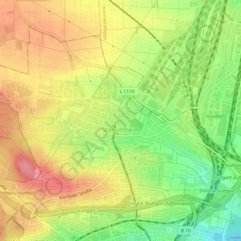
Name: Stammheim topographic map, elevation, terrain.
Location: Stammheim, Stuttgart, Baden-Württemberg, 70439, Deutschland (48.83976 9.13364 48.86191 9.17626)
Average elevation: 313 m
Minimum elevation: 265 m
Maximum elevation: 353 m
Other topographic maps
Click on a map to view its topography, its elevation and its terrain.
Lemberg
Deutschland > Baden-Württemberg > Stuttgart
Lemberg, Stuttgart, Baden-Württemberg, 70469, Deutschland
Average elevation: 322 m