
Bushnell topographic map
Interactive map
Click on the map to display elevation.
About this map
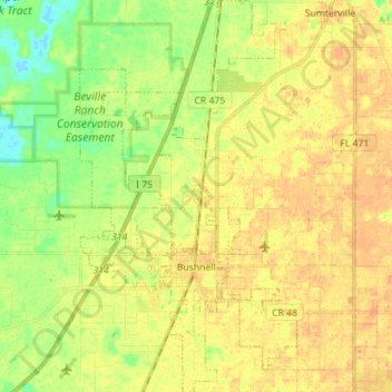
Name: Bushnell topographic map, elevation, terrain.
Location: Bushnell, Sumter County, Florida, United States (28.62479 -82.15383 28.74883 -82.07550)
Average elevation: 22 m
Minimum elevation: 3 m
Maximum elevation: 34 m
Other topographic maps
Click on a map to view its topography, its elevation and its terrain.
The Villages
United States > Florida > Sumter County
The Villages, Sumter County, Florida, United States
Average elevation: 25 m
Wildwood
United States > Florida > Sumter County
Wildwood, Sumter County, Florida, United States
Average elevation: 23 m
Webster
United States > Florida > Sumter County
Webster, Sumter County, Florida, United States
Average elevation: 28 m