
Долна кула topographic map
Interactive map
Click on the map to display elevation.
About this map
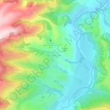
Name: Долна кула topographic map, elevation, terrain.
Location: Долна кула, Крумовград, Oblast Kardschali, Bulgarien (41.53919 25.62158 41.57919 25.66158)
Average elevation: 327 m
Minimum elevation: 165 m
Maximum elevation: 640 m