
Ynyshir topographic map
Interactive map
Click on the map to display elevation.
About this map
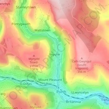
Name: Ynyshir topographic map, elevation, terrain.
Location: Ynyshir, Rhondda Cynon Taf, Wales, CF39 0EL, United Kingdom (51.60625 -3.43239 51.64625 -3.39239)
Average elevation: 235 m
Minimum elevation: 73 m
Maximum elevation: 379 m