
Santa Martha topographic map
Interactive map
Click on the map to display elevation.
About this map
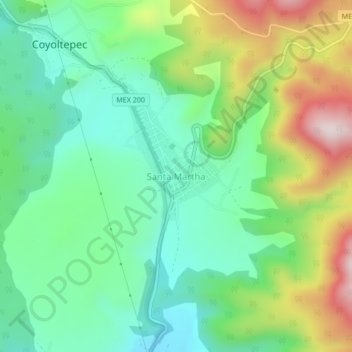
Name: Santa Martha topographic map, elevation, terrain.
Location: Santa Martha, Ocuilan, État de Mexico, Mexique (19.04038 -99.40173 19.08038 -99.36173)
Average elevation: 2,920 m
Minimum elevation: 2,741 m
Maximum elevation: 3,276 m