Geolocate

Magsaysay topographic map

Click on the map to display elevation.

About this map
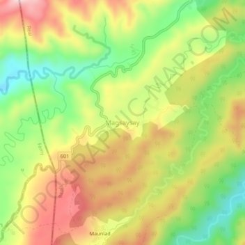
Name: Magsaysay topographic map, elevation, terrain.

Location: Magsaysay, Siniloan, Quezon, Calabarzon, Philippines (14.47927 121.50379 14.51927 121.54379)

Average elevation: 366 m

Minimum elevation: 218 m

Maximum elevation: 517 m

Gear up for your next adventure:

❄️Walking Crampons - Added traction for icy slopes and winter peak bagging
⛺Camping Shelters - Emergency and lightweight shelters for outdoor use
🥾Women's Waterproof Hiking Boots - High-performance trekking boots designed for all-weather comfort
📸Action Camera Chest Mounts - Record your ascent following topographic paths hands-free
👖Convertible Hiking Trousers - Versatile zip-off pants for changing mountain weather conditions

As an Amazon Associate, this site earns from qualifying purchases at no extra cost to you.