Geolocate

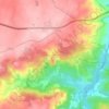
Azinhal topographic map

Click on the map to display elevation.

About this map

Name: Azinhal topographic map, elevation, terrain.

Location: Azinhal, Almeida, Guarda, Portugal (40.67122 -7.00626 40.70689 -6.92945)

Average elevation: 682 m

Minimum elevation: 523 m

Maximum elevation: 760 m

Other topographic maps

Click on a map to view its topography, its elevation and its terrain.
Castelo Mendo

Portugal > Guarda > Almeida

Average elevation: 722 m

Jardo

Portugal > Guarda > Almeida

Average elevation: 721 m

Pailobo

Portugal > Guarda > Almeida > Pailobo

Average elevation: 773 m

Peva

Portugal > Guarda > Almeida

Average elevation: 705 m

Castelo Mendo

Portugal > Guarda > Almeida

Average elevation: 722 m

Gear up for your next adventure:

🧵Survival Paracord - Multi-purpose cordage for emergency repairs and shelters
🗺️Topographic Maps - Detailed maps showing elevation and terrain features
🗺️Ordnance Survey Maps - Essential paper maps for hiking across the UK national parks
🥤Hiking Water Bottles - Reusable bottles for hydration on the trail
🌦️Portable Weather Meters - Handheld tools for monitoring weather conditions

As an Amazon Associate, this site earns from qualifying purchases at no extra cost to you.