Geolocate

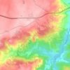
São Pedro de Rio Seco topographic map

Click on the map to display elevation.

São Pedro de Rio Seco

A lontra tem como limite territorial uma altitude à volta dos 750m, atingindo nesta zona esse limite.

Wikipedia (CC-BY-SA 3.0)

About this map

Name: São Pedro de Rio Seco topographic map, elevation, terrain.

Location: São Pedro de Rio Seco, Almeida, Guarda, Portugal (40.63493 -6.86300 40.68185 -6.79401)

Average elevation: 774 m

Minimum elevation: 736 m

Maximum elevation: 808 m

Other topographic maps

Click on a map to view its topography, its elevation and its terrain.
Castelo Mendo

Portugal > Guarda > Almeida

Average elevation: 722 m

Jardo

Portugal > Guarda > Almeida

Average elevation: 721 m

Pailobo

Portugal > Guarda > Almeida > Pailobo

Average elevation: 773 m

Peva

Portugal > Guarda > Almeida

Average elevation: 705 m

Castelo Mendo

Portugal > Guarda > Almeida

Average elevation: 722 m

Gear up for your next adventure:

👟Heavy Duty Boot Laces - Always carry a spare for your hiking footwear
🧭Professional Hiking Compasses - High-precision liquid-filled compasses for map reading and orientation
👟Waterproof Leg Gaiters - Keep mud and water out of your boots in boggy terrain
🧣Fleece Neck Warmers - Extra insulation for winter topographic surveys
🔦Keychain LED Torches - Emergency backup light for finding gear in your pack

As an Amazon Associate, this site earns from qualifying purchases at no extra cost to you.