Geolocate

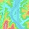
Geumsan-ri topographic map

Click on the map to display elevation.

About this map

Name: Geumsan-ri topographic map, elevation, terrain.

Location: Geumsan-ri, Chuncheon-si, Gangwon State, 24461, South Korea (37.87878 127.67473 37.91878 127.71473)

Average elevation: 99 m

Minimum elevation: 70 m

Maximum elevation: 297 m

Other topographic maps

Click on a map to view its topography, its elevation and its terrain.

Dongsan-myeon

South Korea > Chuncheon-si

Average elevation: 331 m

Nami Island

South Korea > Chuncheon-si

Average elevation: 107 m

24265

South Korea > Chuncheon-si

Average elevation: 97 m

24422

South Korea > Chuncheon-si

Average elevation: 111 m

24465

South Korea > Chuncheon-si

Average elevation: 221 m

24449

South Korea > Chuncheon-si

Average elevation: 104 m

24333

South Korea > Chuncheon-si

Average elevation: 101 m

24279

South Korea > Chuncheon-si

Average elevation: 111 m

24266

South Korea > Chuncheon-si

Average elevation: 95 m

24277

South Korea > Chuncheon-si

Average elevation: 110 m

Gear up for your next adventure:

🚶Walking Pedometers - Simple distance tracking for casual trail walkers
🥤Collapsible Water Bottles - Save space in your rucksack as you consume your water
📸Action Camera Chest Mounts - Record your ascent following topographic paths hands-free
👟Waterproof Leg Gaiters - Keep mud and water out of your boots in boggy terrain
🧤Thermal Touchscreen Gloves - Stay warm while operating your GPS or smartphone camera

As an Amazon Associate, this site earns from qualifying purchases at no extra cost to you.