Geolocate

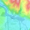
Chauffour topographic map

Click on the map to display elevation.

About this map

Name: Chauffour topographic map, elevation, terrain.

Location: Chauffour, Orbeil, Issoire, Puy-de-Dôme, Auvergne-Rhône-Alpes, France métropolitaine, 63500, France (45.54056 3.26845 45.58056 3.30845)

Average elevation: 437 m

Minimum elevation: 361 m

Maximum elevation: 667 m

Other topographic maps

Click on a map to view its topography, its elevation and its terrain.
Perthus

France > Auvergne-Rhône-Alpes > Puy-de-Dôme > Orbeil

Average elevation: 426 m

Gear up for your next adventure:

🧊Insulated Flasks - Keeps drinks hot or cold during hikes
👕Technical Hiking Tees - Moisture-management for high-exertion climbs
⛺Camping Shelters - Emergency and lightweight shelters for outdoor use
🔦Keychain LED Torches - Emergency backup light for finding gear in your pack
🐕Hiking Dog Harnesses - Rugged harnesses for taking your companion on mountain trails

As an Amazon Associate, this site earns from qualifying purchases at no extra cost to you.