
Tigapanah topographic map
Interactive map
Click on the map to display elevation.
About this map
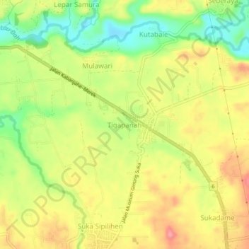
Name: Tigapanah topographic map, elevation, terrain.
Location: Tigapanah, Karo, North Sumatra, 22171, Indonesia (3.05777 98.50113 3.09777 98.54113)
Average elevation: 1,191 m
Minimum elevation: 1,137 m
Maximum elevation: 1,240 m