
Linlithgow topographic map
Click on the map to display elevation.
About this map
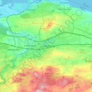
Name: Linlithgow topographic map, elevation, terrain.
Location: Linlithgow, West Lothian, Scotland, EH49 7EY, United Kingdom (55.93717 -3.64062 56.01717 -3.56062)
Average elevation: 95 m
Minimum elevation: -1 m
Maximum elevation: 280 m
West Lothian trails, hiking, mountain biking, running and outdoor activities
Other topographic maps
Click on a map to view its topography, its elevation and its terrain.
Linlithgow Palace and High Street Conservation Area
United Kingdom > Scotland > West Lothian > Linlithgow
Average elevation: 78 m