Geolocate

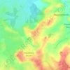
Hazelbury Bryan topographic map

Click on the map to display elevation.

About this map

Name: Hazelbury Bryan topographic map, elevation, terrain.

Location: Hazelbury Bryan, Dorset, England, United Kingdom (50.86208 -2.38940 50.89555 -2.32343)

Average elevation: 91 m

Minimum elevation: 61 m

Maximum elevation: 181 m

Dorset trails, hiking, mountain biking, running and outdoor activities

Other topographic maps

Click on a map to view its topography, its elevation and its terrain.
Kingston

United Kingdom > England > Dorset > Hazelbury Bryan

Average elevation: 85 m

Parkgate

United Kingdom > England > Dorset > Hazelbury Bryan > Parkgate

Average elevation: 105 m

Gear up for your next adventure:

🧦Merino Wool Hiking Socks - Moisture-wicking socks to prevent blisters during long mountain walks
⌚GPS Outdoor Watches - Watches with GPS tracking for hiking and exploration
🧢Thermal Beanie Hats - Prevent heat loss from the head in windy summit conditions
🧺Mesh Stuff Sacks - Breathable storage for wet gear or camp organization
📦Compression Sacks - Reduce backpack volume efficiently

As an Amazon Associate, this site earns from qualifying purchases at no extra cost to you.