Geolocate

Sandomil topographic map

Click on the map to display elevation.

About this map
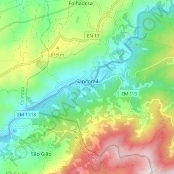
Name: Sandomil topographic map, elevation, terrain.

Location: Sandomil, Seia, Guarda, Portugal (40.33562 -7.80506 40.37593 -7.74045)

Average elevation: 501 m

Minimum elevation: 267 m

Maximum elevation: 924 m

Other topographic maps

Click on a map to view its topography, its elevation and its terrain.
Serra da Estrela

Portugal > Guarda > Seia

Average elevation: 1,825 m

Senhora do Desterro

Portugal > Guarda > Seia

Average elevation: 830 m

Paranhos da Beira

Portugal > Guarda > Seia

Average elevation: 379 m

Gear up for your next adventure:

💧Hydration Reservoirs - Convenient water bladders for hands-free drinking on the move
🛌Sleeping Mats - Insulated mats for comfortable outdoor sleeping
🧷Tenacious Repair Tape - Instant fix for torn tents, jackets, or dry bags
🍲Portable Camping Stoves - Fast-boiling stoves for hot meals on remote topographic survey trips
🚲Bikepacking Frame Bags - Storage for tools and navigation gear on long off-road rides

As an Amazon Associate, this site earns from qualifying purchases at no extra cost to you.