Geolocate

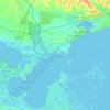
Covington topographic map

Click on the map to display elevation.

About this map
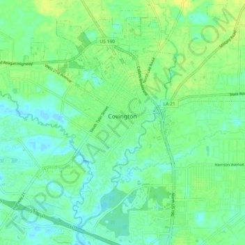
Name: Covington topographic map, elevation, terrain.

Location: Covington, St. Tammany Parish, Louisiana, United States (30.43985 -90.17145 30.50666 -90.08112)

Average elevation: 9 m

Minimum elevation: 1 m

Maximum elevation: 19 m

Other topographic maps

Click on a map to view its topography, its elevation and its terrain.

Bush

United States > Louisiana > St. Tammany Parish

Average elevation: 22 m

Bush

United States > Louisiana > St. Tammany Parish

Average elevation: 22 m

Gear up for your next adventure:

🧣Neck Gaiters - Protects against wind and sun on exposed ridges and peaks
👕Technical Hiking Tees - Moisture-management for high-exertion climbs
🥾Hiking Boot Waterproofing Wax - Maintain the lifespan of your leather trekking boots
🥾Men's Waterproof Hiking Boots - Durable footwear with deep lugs for muddy and rocky UK terrains
⌚GPS Outdoor Watches - Watches with GPS tracking for hiking and exploration

As an Amazon Associate, this site earns from qualifying purchases at no extra cost to you.