
Dairomont topographic map
Interactive map
Click on the map to display elevation.
About this map
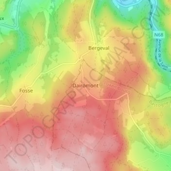
Name: Dairomont topographic map, elevation, terrain.
Location: Dairomont, Vielsalm, Bastenaken, Luxemburg, Wallonië, België (50.32216 5.84292 50.36216 5.88292)
Average elevation: 430 m
Minimum elevation: 259 m
Maximum elevation: 558 m