
Chambal topographic map
Interactive map
Click on the map to display elevation.
About this map
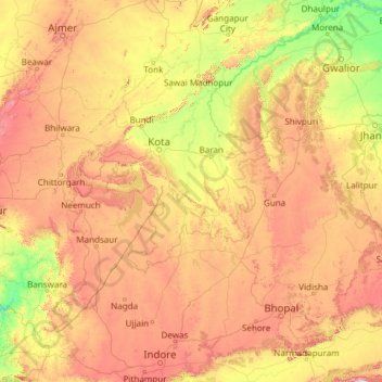
Name: Chambal topographic map, elevation, terrain.
Location: Chambal, Digod Tehsil, Kota, Rajasthan, 323600, Indien (22.51903 75.26579 26.86972 79.24912)
Average elevation: 381 m
Minimum elevation: 114 m
Maximum elevation: 890 m
Other topographic maps
Click on a map to view its topography, its elevation and its terrain.
Tarwara
Indien > Rajasthan > Ahore Tehsil > Tarwara
Tarwara, Ahore Tehsil, Jalor, Rajasthan, Indien
Average elevation: 218 m