Geolocate

Chatfield topographic map

Interactive map

Click on the map to display elevation.

About this map

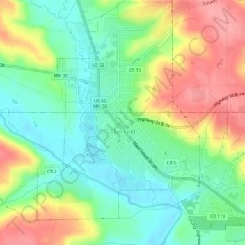
Name: Chatfield topographic map, elevation, terrain.

Location: Chatfield, Fillmore County, Minnesota, 55923, United States (43.82981 -92.20397 43.86184 -92.15875)

Average elevation: 327 m

Minimum elevation: 287 m

Maximum elevation: 385 m

Other topographic maps

Click on a map to view its topography, its elevation and its terrain.

Harmony

United States > Minnesota > Fillmore County

Harmony, Fillmore County, Minnesota, 55939, United States

Average elevation: 404 m

Rushford

United States > Minnesota > Fillmore County

Rushford, Fillmore County, Minnesota, 55971, United States

Average elevation: 255 m