
Chemin-des-Pins topographic map
Interactive map
Click on the map to display elevation.
About this map
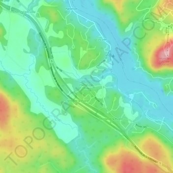
Name: Chemin-des-Pins topographic map, elevation, terrain.
Average elevation: 153 m
Minimum elevation: 91 m
Maximum elevation: 290 m
Other topographic maps
Click on a map to view its topography, its elevation and its terrain.
Île des Pins
Canada > Québec > Les Collines-de-l'Outaouais > Chelsea
Île des Pins, Chelsea, Les Collines-de-l'Outaouais, Outaouais, Québec, Canada
Average elevation: 194 m