
Sutton Green topographic map
Click on the map to display elevation.
About this map
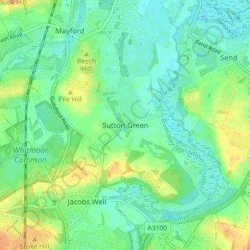
Name: Sutton Green topographic map, elevation, terrain.
Location: Sutton Green, Woking, Surrey, England, GU4 7QD, United Kingdom (51.26044 -0.57841 51.30044 -0.53841)
Average elevation: 32 m
Minimum elevation: 20 m
Maximum elevation: 55 m
Surrey trails, hiking, mountain biking, running and outdoor activities
Other topographic maps
Click on a map to view its topography, its elevation and its terrain.
Horsell Common
United Kingdom > England > Surrey > Woking > Horsell > Durnford Farm
Average elevation: 29 m