Geolocate

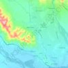
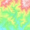
Mount Piora topographic map

Click on the map to display elevation.

About this map

Name: Mount Piora topographic map, elevation, terrain.

Location: Mount Piora, Markham District, Morobe, Momase Region, Papua New Guinea (-6.72547 145.98796 -6.72537 145.98806)

Average elevation: 3,249 m

Minimum elevation: 2,621 m

Maximum elevation: 3,529 m

Other topographic maps

Click on a map to view its topography, its elevation and its terrain.
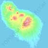
Umboi Island

Papua New Guinea > Morobe

Average elevation: 177 m

Butibum River

Papua New Guinea > Morobe > Lae District > Lae

Average elevation: 71 m

Umboi Island

Papua New Guinea > Morobe

Average elevation: 177 m

Leron River

Papua New Guinea > Morobe

Average elevation: 633 m

Buso River

Papua New Guinea > Morobe > Busung

Average elevation: 1,021 m

Gear up for your next adventure:

❄️Walking Crampons - Added traction for icy slopes and winter peak bagging
🎒Hiking Daypacks (20L) - Compact backpacks for day trips and technical mountain ascents
🧢Waterproof Hiking Hats - Keep the rain off your face while studying topographic maps
🎒Multi-day Trekking Packs - Large capacity backpacks for wild camping and long-distance trails
🧭Emergency Beacons - Safety beacons for remote outdoor locations

As an Amazon Associate, this site earns from qualifying purchases at no extra cost to you.