
Thank you for supporting this site ❤️
Make a donation
Make a donation
Gear up for your next adventure:
As an Amazon Associate, this site earns from qualifying purchases at no extra cost to you.
Mezzacca topographic map
Click on the map to display elevation.
Thank you for supporting this site ❤️
Make a donation
Make a donation
Gear up for your next adventure:
As an Amazon Associate, this site earns from qualifying purchases at no extra cost to you.
About this map
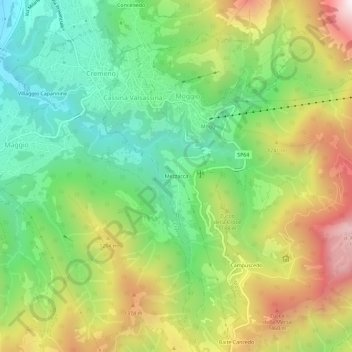
Name: Mezzacca topographic map, elevation, terrain.
Location: Mezzacca, Cassina Valsassina, Lecco, Lombardia, 23817, Italia (45.90315 9.46606 45.94315 9.50606)
Average elevation: 1,051 m
Minimum elevation: 607 m
Maximum elevation: 1,714 m
Thank you for supporting this site ❤️
Make a donation
Make a donation
Gear up for your next adventure:
As an Amazon Associate, this site earns from qualifying purchases at no extra cost to you.