Geolocate

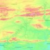
Rooiberg topographic map

Click on the map to display elevation.

About this map

Name: Rooiberg topographic map, elevation, terrain.

Location: Rooiberg, George, Western Cape, South Africa (-33.67175 22.26665 -33.67165 22.26675)

Average elevation: 488 m

Minimum elevation: 330 m

Maximum elevation: 645 m

Other topographic maps

Click on a map to view its topography, its elevation and its terrain.
Kannaland Ward 4

South Africa > Western Cape > George

Average elevation: 585 m

Touwsranten

South Africa > Western Cape > George

Average elevation: 202 m

Danabaai

South Africa > Western Cape > George

Average elevation: 109 m

Oudtshoorn

South Africa > Western Cape > George

Average elevation: 353 m

Oudtshoorn

South Africa > Western Cape > George

Average elevation: 353 m

Garden Route Dam

South Africa > Western Cape > George

Average elevation: 200 m

Oudtshoorn

South Africa > Western Cape > George

Average elevation: 353 m

Friemersheim

South Africa > Western Cape > George

Average elevation: 262 m

Gear up for your next adventure:

🎒Multi-day Trekking Packs - Large capacity backpacks for wild camping and long-distance trails
🧢Thermal Beanie Hats - Prevent heat loss from the head in windy summit conditions
🥫Expedition Meals - Lightweight, high-calorie nutrition for long-distance hikers
🧦Hiking Socks - Breathable socks designed to prevent blisters on long walks
🧺Mesh Stuff Sacks - Breathable storage for wet gear or camp organization

As an Amazon Associate, this site earns from qualifying purchases at no extra cost to you.