
Thank you for supporting this site ❤️
Make a donation
Make a donation
Gear up for your next adventure:
As an Amazon Associate, this site earns from qualifying purchases at no extra cost to you.
Saltcoats topographic map
Click on the map to display elevation.
Thank you for supporting this site ❤️
Make a donation
Make a donation
Gear up for your next adventure:
As an Amazon Associate, this site earns from qualifying purchases at no extra cost to you.
About this map
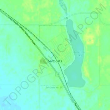
Name: Saltcoats topographic map, elevation, terrain.
Location: Saltcoats, Saskatchewan, S0A 3R0, Canada (51.03335 -102.17763 51.04806 -102.15607)
Average elevation: 530 m
Minimum elevation: 523 m
Maximum elevation: 540 m
Thank you for supporting this site ❤️
Make a donation
Make a donation
Gear up for your next adventure:
As an Amazon Associate, this site earns from qualifying purchases at no extra cost to you.