Geolocate

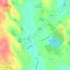
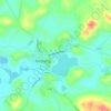
Monaghan topographic map

Click on the map to display elevation.

About this map

Name: Monaghan topographic map, elevation, terrain.

Location: Monaghan, Monaghan Municipal District, County Monaghan, Ulster, Ireland (54.22935 -6.99835 54.26606 -6.94155)

Average elevation: 71 m

Minimum elevation: 49 m

Maximum elevation: 141 m

Other topographic maps

Click on a map to view its topography, its elevation and its terrain.

Lough Egish

Ireland > County Monaghan

Average elevation: 158 m

Magheracloone

Ireland > County Monaghan

Average elevation: 57 m

Annayalla

Ireland > County Monaghan

Average elevation: 123 m

Newbliss

Ireland > County Monaghan > Newbliss

Average elevation: 115 m

Ballybay Town Park

Ireland > County Monaghan

Average elevation: 94 m

Lough Fea

Ireland > County Monaghan

Average elevation: 50 m

Tydavnet

Ireland > County Monaghan

Average elevation: 88 m

Inniskeen

Ireland > County Monaghan

Average elevation: 60 m

Gear up for your next adventure:

🧺Mesh Stuff Sacks - Breathable storage for wet gear or camp organization
🧊Personal Water Filters - Drink safely from mountain streams marked on your map
🧴Tick Removal Tools - Small, essential health tool for UK woodland and moorland
🌂Windproof Trekking Umbrellas - Surprising but effective rain protection on low-wind trails
📱Rugged Phone Cases - Heavy-duty protection for smartphones used as secondary GPS tools

As an Amazon Associate, this site earns from qualifying purchases at no extra cost to you.