
Thank you for supporting this site ❤️
Make a donation
Make a donation
Gear up for your next adventure:
As an Amazon Associate, this site earns from qualifying purchases at no extra cost to you.
Alt-Radebeul topographic map
Click on the map to display elevation.
Thank you for supporting this site ❤️
Make a donation
Make a donation
Gear up for your next adventure:
As an Amazon Associate, this site earns from qualifying purchases at no extra cost to you.
About this map
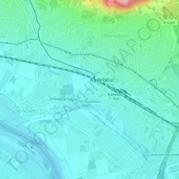
Name: Alt-Radebeul topographic map, elevation, terrain.
Location: Alt-Radebeul, Radebeul, Meißen, Sachsen, Deutschland (51.08851 13.66639 51.10842 13.70111)
Average elevation: 121 m
Minimum elevation: 99 m
Maximum elevation: 234 m
Thank you for supporting this site ❤️
Make a donation
Make a donation
Gear up for your next adventure:
As an Amazon Associate, this site earns from qualifying purchases at no extra cost to you.