
Галата topographic map
Interactive map
Click on the map to display elevation.
About this map
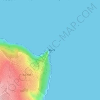
Name: Галата topographic map, elevation, terrain.
Location: Галата, Galata, Varna, 9001, Bulgaria (43.17167 27.94598 43.17177 27.94608)
Average elevation: 28 m
Minimum elevation: -3 m
Maximum elevation: 177 m
Other topographic maps
Click on a map to view its topography, its elevation and its terrain.