
Sandersville topographic map
Interactive map
Click on the map to display elevation.
Sandersville
According to the United States Census Bureau, the city has a total area of 10.45 square kilometres (4.03 sq mi), of which 9.1 square miles (24 km2) is land and 0.1 square miles (0.26 km2) (0.87%) is water. The area is along the "Fall Line" that separates the Piedmont Plateau and the Atlantic Coastal Plain and is characterized by rolling hills, red clay, pine and hardwood forest, swamplands, and sand beds. The area tapers off from North to South and becomes more flat. Heading north it becomes more hilly with higher elevations.
About this map
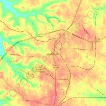
Name: Sandersville topographic map, elevation, terrain.
Average elevation: 130 m
Minimum elevation: 87 m
Maximum elevation: 156 m