
Cortegada topographic map
Interactive map
Click on the map to display elevation.
About this map
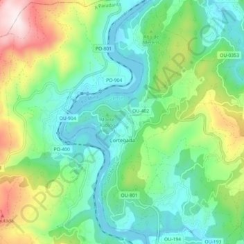
Name: Cortegada topographic map, elevation, terrain.
Location: Cortegada, O Ribeiro, Ourense, Galice, 32200, Espagne (42.17926 -8.19226 42.24513 -8.11529)
Average elevation: 276 m
Minimum elevation: 65 m
Maximum elevation: 794 m
Other topographic maps
Click on a map to view its topography, its elevation and its terrain.