
Thank you for supporting this site ❤️
Make a donation
Make a donation
Gear up for your next adventure:
As an Amazon Associate, this site earns from qualifying purchases at no extra cost to you.
Chontabamba topographic map
Click on the map to display elevation.
Thank you for supporting this site ❤️
Make a donation
Make a donation
Gear up for your next adventure:
As an Amazon Associate, this site earns from qualifying purchases at no extra cost to you.
About this map
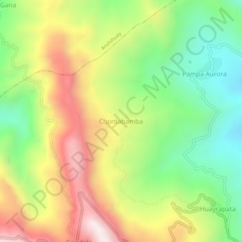
Name: Chontabamba topographic map, elevation, terrain.
Location: Chontabamba, Anco, Provincia de La Mar, Ayacucho, Perú (-12.94232 -73.59936 -12.90232 -73.55936)
Average elevation: 1,434 m
Minimum elevation: 1,037 m
Maximum elevation: 1,935 m
Thank you for supporting this site ❤️
Make a donation
Make a donation
Gear up for your next adventure:
As an Amazon Associate, this site earns from qualifying purchases at no extra cost to you.