
Thank you for supporting this site ❤️
Make a donation
Make a donation
Gear up for your next adventure:
As an Amazon Associate, this site earns from qualifying purchases at no extra cost to you.
Tankulan topographic map
Click on the map to display elevation.
Thank you for supporting this site ❤️
Make a donation
Make a donation
Gear up for your next adventure:
As an Amazon Associate, this site earns from qualifying purchases at no extra cost to you.
About this map
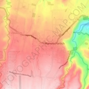
Name: Tankulan topographic map, elevation, terrain.
Location: Tankulan, Bukidnon, Northern Mindanao, 8703, Philippines (8.34737 124.84171 8.38737 124.88171)
Average elevation: 502 m
Minimum elevation: 299 m
Maximum elevation: 584 m
Thank you for supporting this site ❤️
Make a donation
Make a donation
Gear up for your next adventure:
As an Amazon Associate, this site earns from qualifying purchases at no extra cost to you.