
Garson topographic map
Click on the map to display elevation.
About this map
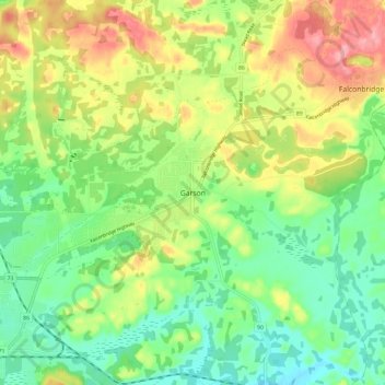
Name: Garson topographic map, elevation, terrain.
Average elevation: 292 m
Minimum elevation: 251 m
Maximum elevation: 352 m
Other topographic maps
Click on a map to view its topography, its elevation and its terrain.
Lake Laurentian Conservation Area
Canada > Ontario > Sudbury District > Greater Sudbury > McFarlane Lake
Average elevation: 264 m
Lake Laurentian
Canada > Ontario > Sudbury District > Greater Sudbury > McFarlane Lake
Average elevation: 270 m