
Al Sir topographic map
Interactive map
Click on the map to display elevation.
About this map
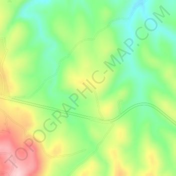
Name: Al Sir topographic map, elevation, terrain.
Location: Al Sir, Tafilah, Jordan (30.82333 35.67333 30.84333 35.69333)
Average elevation: 1,187 m
Minimum elevation: 1,103 m
Maximum elevation: 1,305 m
Other topographic maps
Click on a map to view its topography, its elevation and its terrain.
Al Ain al Bayda
Jordan > Tafilah > At Tafila Sub-District
Al Ain al Bayda, At Tafila Sub-District, Tafilah Qasabah District, Tafilah, Jordan
Average elevation: 1,156 m
Dana Biosphere Reserve
Dana Biosphere Reserve, Tafilah, Jordan
Average elevation: 222 m