
Thank you for supporting this site ❤️
Make a donation
Make a donation
Gear up for your next adventure:
As an Amazon Associate, this site earns from qualifying purchases at no extra cost to you.
Sillustani topographic map
Click on the map to display elevation.
Thank you for supporting this site ❤️
Make a donation
Make a donation
Gear up for your next adventure:
As an Amazon Associate, this site earns from qualifying purchases at no extra cost to you.
About this map
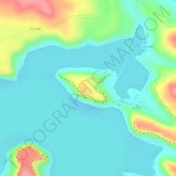
Name: Sillustani topographic map, elevation, terrain.
Location: Sillustani, PU-1047, Atuncolla, Puno, Perú (-15.72379 -70.16056 -15.71945 -70.15539)
Average elevation: 3,858 m
Minimum elevation: 3,828 m
Maximum elevation: 3,932 m
Thank you for supporting this site ❤️
Make a donation
Make a donation
Gear up for your next adventure:
As an Amazon Associate, this site earns from qualifying purchases at no extra cost to you.