
Roborough topographic map
Click on the map to display elevation.
About this map
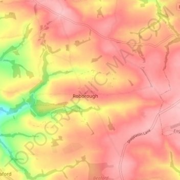
Name: Roborough topographic map, elevation, terrain.
Location: Roborough, Torridge District, Devon, England, United Kingdom (50.91795 -4.06361 50.95582 -3.99320)
Average elevation: 159 m
Minimum elevation: 70 m
Maximum elevation: 199 m
Devon trails, hiking, mountain biking, running and outdoor activities
Other topographic maps
Click on a map to view its topography, its elevation and its terrain.
Hartland Point
United Kingdom > England > Devon > Torridge District > Hartland
Average elevation: 20 m
Woollaton
United Kingdom > England > Devon > Torridge District > Peters Marland
Average elevation: 138 m