
Super Pal topographic map
Interactive map
Click on the map to display elevation.
About this map
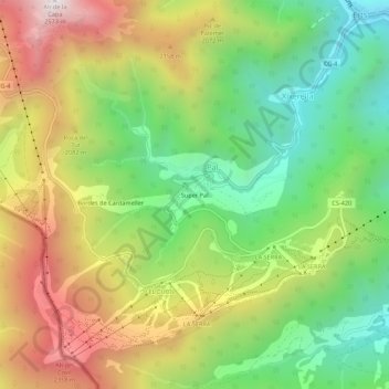
Name: Super Pal topographic map, elevation, terrain.
Location: Super Pal, Pal, La Massana, AD400, Andorra (42.52295 1.45349 42.56295 1.49349)
Average elevation: 1,856 m
Minimum elevation: 1,327 m
Maximum elevation: 2,548 m