
tuta topographic map
Interactive map
Click on the map to display elevation.
About this map
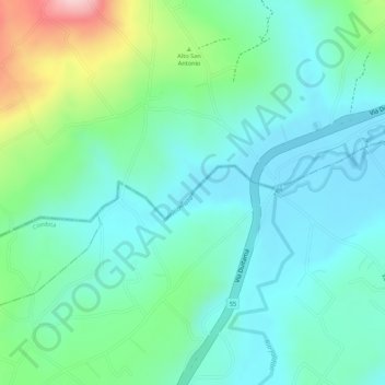
Name: tuta topographic map, elevation, terrain.
Location: tuta, Tuta, Centro, Boyacá, Colombia (5.70473 -73.25647 5.70848 -73.24346)
Average elevation: 2,604 m
Minimum elevation: 2,542 m
Maximum elevation: 2,771 m
Other topographic maps
Click on a map to view its topography, its elevation and its terrain.
Río Chicamocha
Colombia > Boyacá > Tuta > Tuta
Río Chicamocha, Tuta, Centro, Boyacá, Colombia
Average elevation: 2,576 m