Geolocate

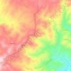
Fonte Longa topographic map

Click on the map to display elevation.

About this map

Name: Fonte Longa topographic map, elevation, terrain.

Location: Fonte Longa, Mêda, Outeiro de Gatos e Fonte Longa, Mêda, Guarda, Portugal (40.99817 -7.23952 41.03748 -7.19041)

Average elevation: 528 m

Minimum elevation: 263 m

Maximum elevation: 709 m

Other topographic maps

Click on a map to view its topography, its elevation and its terrain.
Gear up for your next adventure:

🗺️Ordnance Survey Maps - Official UK maps for walking and outdoor activities
📸Action Camera Chest Mounts - Record your ascent following topographic paths hands-free
🌄Outdoor Binoculars - Compact binoculars for landscape observation
🩹Hiking First Aid Kits - Compact medical kits tailored for trail injuries and emergencies
⌚GPS Outdoor Watches - Watches with GPS tracking for hiking and exploration

As an Amazon Associate, this site earns from qualifying purchases at no extra cost to you.