Geolocate

Jackson topographic map

Click on the map to display elevation.

About this map

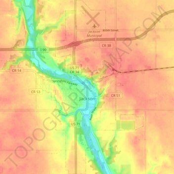
Name: Jackson topographic map, elevation, terrain.

Location: Jackson, Jackson County, Minnesota, 56143, United States (43.59334 -95.01435 43.65631 -94.96052)

Average elevation: 432 m

Minimum elevation: 394 m

Maximum elevation: 449 m

Gear up for your next adventure:

🥤Hiking Water Bottles - Reusable bottles for hydration on the trail
👟Heavy Duty Boot Laces - Always carry a spare for your hiking footwear
📐Altimeters & Barometers - Tools for measuring altitude and air pressure
🔦Keychain LED Torches - Emergency backup light for finding gear in your pack
🧼Technical Clothing Wash - Special soap to clean and restore waterproof membranes

As an Amazon Associate, this site earns from qualifying purchases at no extra cost to you.